Canoe the Ausable River, Ontario
Note: Click on all pictures to enlarge... Driving east from Sarnia, Ontario 56 kilometers, along Lakeshore Road that turns into Hwy 21, you reach the bridge over the Ausable River. Do not go over the bridge. Instead take the first street (Northville Cr.) north and enter the first driveway (less than a stone's throw from Hwy 21). Here you are entering the Ausable River put-in:
THEDFORD CONSERVATION AREA -
THE AUSABLE/BAYFIELD CONSERVATION AUTHORITY.
There is a portage of 110 metres that takes you to an embankment, made
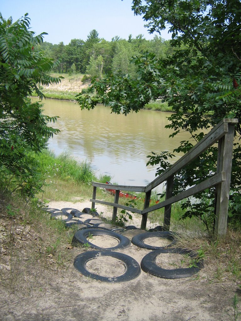 out of tires set into the side for
 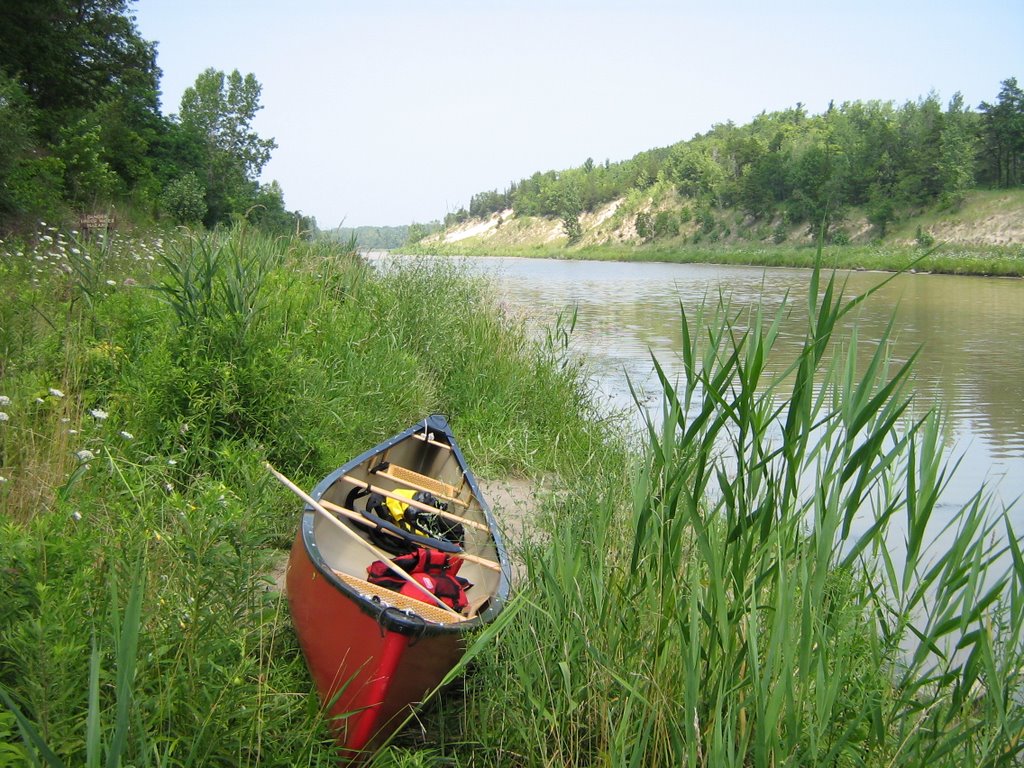 easy stepping). Note there is not very much room at the bank of the river to put-in; you must watch out for a couple of rocks that are in the way. There is just enough room to slide your canoe into the river.
Once in the river you can head east to reach the Old Ausable River that winds its way into the Attawandaron Scout Reserve and continu
 es on into the Pinery Provincial Park.
I put-in at 1305 hours and headed northward towards the Old Ausable section of the river. If you kept going northward you would eventually end up in Lake Huron, a few miles ahead. The first building you will see is a homemade white lighthouse-looking structure, located on the west bank. I stopped on the east side across from this structure at 1325-1340 hrs. for lunch.
After lunch I he
 aded northward again and at 1350 hours I hit
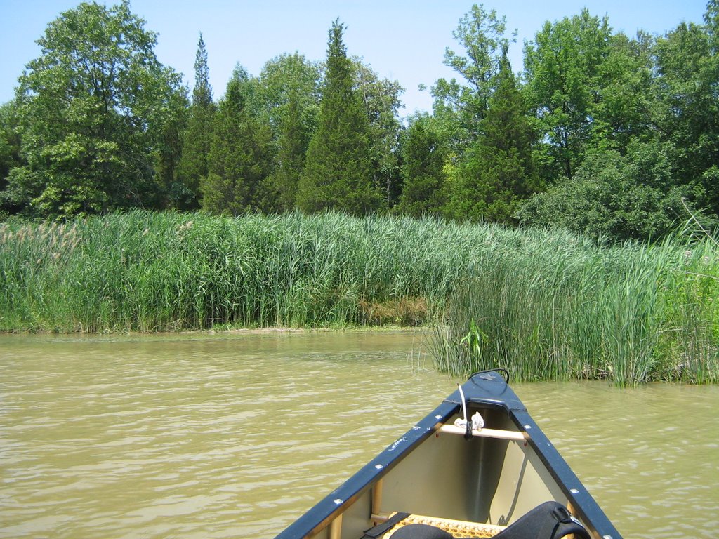
  the cut of the river that turns eastward into the Scout camp and the Pinery park. The water level in this part of the river is about 1/2 metre to a metre deep and there is heavy vegetation in the water that makes for a slow paddle. But "slow" is the operative word of the day in this passage. Taking your time, keep an eye for hawks, snapping turtles, a beaver dam in the making, and lots of small fish schooling around the canoe. If you are lucky you will encounter some deer along the way. Rare sightings of eagles have been noted.
Going over the beaver dam in the making is a challenge as the water is barely navagatible being inches deep, however if you m
 ake a run at it you will easily slide over the obstruction. I did some poling along the way which added to my adventure and gave me some extra time to glide along and watch out for wild life on the banks. This section of the river twists and winds its way through the two parks and allows for magnificent scenery on either side. Hugh sand banks, topped with various trees and vegetation are found first on the trip and soon you are entering a heavily forested area. There are many spots to stop and get out for a hike along the many trails that have been carved out by others who have made this trip.
At 1415, knowing I had to get home soon, I stopped and turned the canoe around, all the while noting that I will be back another time to go further along this route. The point where I turned around there was a large dead tree stump to the right that cannot be missed. I am not sure how far I was along the Old Ausable section that since I did not have a topo with me, however I sense that I was about a mile and a half into the old section of the river.
One negative note that must be stated is the fools who are on power boats and jet skis. I passed four boats and two jet skis. Only one boat went slow, all the others thought it was neat to go full throttle and swamp the canoeist. It is too bad these types of boaters are out there; the problem goes further when these humans take to the wheel on the highway drive home with the same attitude towards others...Enough said, you know what I am saying.
On the way back towards the put-in spot I spotted a group of hawks sun
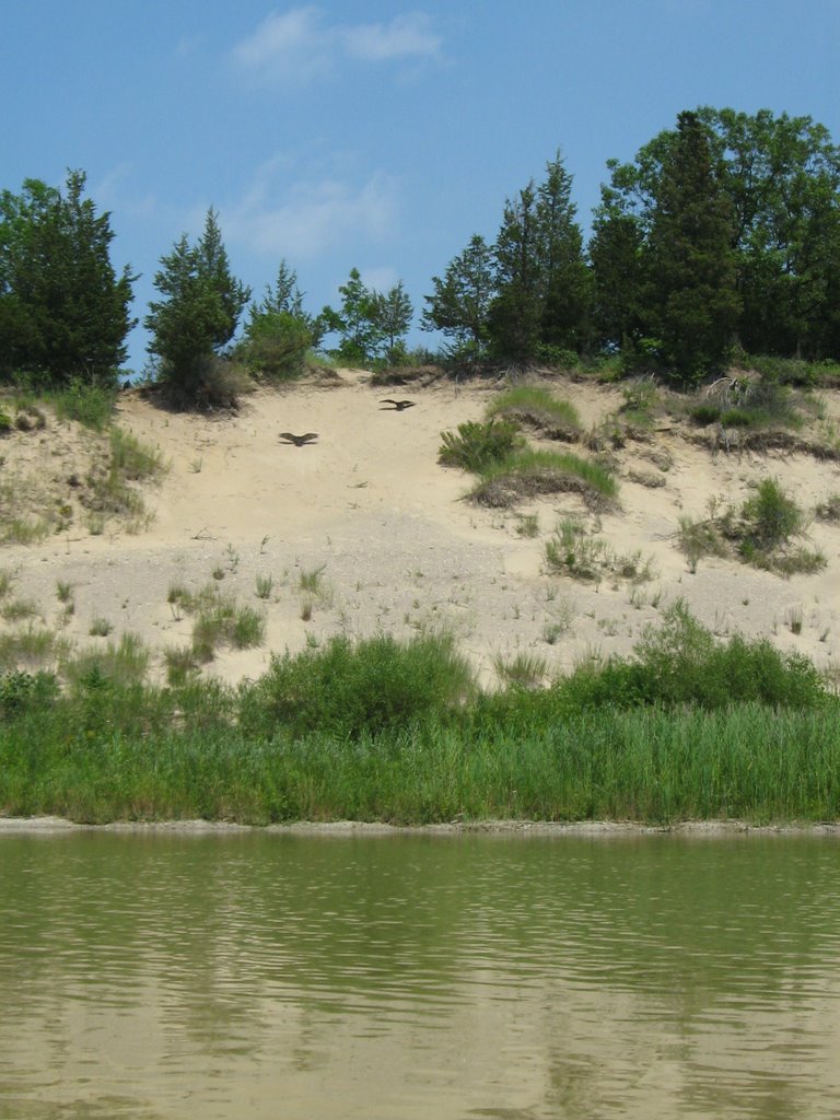 tanning themselves on the huge sand dunes; the very same dunes that our Beavers hiked up from the river last year.
So, if you are looking to a nice paddle this is the route. I would suggest starting out early in the day, take lots of water, sunscreen, and a jug of deet for the trip up the Old Ausable. A topo map is on my list, as I am interested in the history of this river and certainly would like to know where I am going and where I have been.
Getting back to nature is healthy for everyone!
Please email me if you have had any adventures up the Old Ausable: prospector16@gmail.com
posted by Gregory West - Computer Instructor & Freelance Writer @ 08:03
2 Comments
![]()
![]()


2 Comments:
Excellent review
Looks very relaxing, a little calmer than Georgian bay
Post a Comment
Subscribe to Post Comments [Atom]
<< Home